down to the shouting sea

Rockaway beach Pacifica June 2020
Taking a break from posting about my virtual tour of Great Britain. The shelter-in-place is tough. As much as I love being at home around all my stuff, in this oppressive Davis heat some cooler outside time is needed, and in California you cool off at the beach. That is where the cool air blows in. We took a day in Pacifica, just south of San Francisco, sat on the beach at Rockaway. It’s nice there, although my legs got a bit burnt as the rays snuck undetected through the bands of fog, and my sunscreen wasn’t quite thick enough. We had missed out on an expected weekend here in May, when the soccer tournament we’d signed our team up for was cancelled. Shame; I was hoping to win it this time. I didn’t climb the rocks, but I drew them, so that’s the same. In this sketch I actually used a masking fluid pen for the waves, I had picked that up in London last year, I don’t use it much but it was great for this purpose. I had sand in the fingers and sand between my toes. This reminds me of the illustration in the A.A.Milne book, “When We Were Very Young”, specifically the one for the poem I just mentioned, “Sand-Between-The-Toes”. I loved that book as a kid, and loved it as a parent too when my son was really small, but I really loved the drawings, and especially that one. It reminded me of being at beaches on cold, windswept days, looking out at the sea, tasting salt in the air, then heading somewhere warm for fish and chips and a cup of tea. On this day in Pacifica, we were masked up down at the beach, thankfully not too many people about, before walking around the little community of Rockaway Beach a bit, and getting a milkshake at Johnny Rocket’s (although I got the wrong flavour, in a case of misunderstanding through the mask).

Jeez I want all this to be over, this bloody pandemic, but it’s not. I have been posting on Twitter a bunch of “this time last year” or “on this day in 2016” or whenever posts, showing where I was and what I was sketching, somewhere far away in a time when people were fine mingling all together. This time last year we were on our summer trip through Holland and Belgium and France, and then London, and this year we had hoped to see Italy again, but Americans can’t go anywhere now. We did manage to take a few days earlier this month to drive down Big Sur, which was pretty spectacular. I suppose if you’re going to be stuck anywhere, California is a pretty nice place to be. Just this Davis summer heat, it’s oppressive.

(21) Barnstaple, (22) Bristol, and (23) Bath

GB 21-23 sm
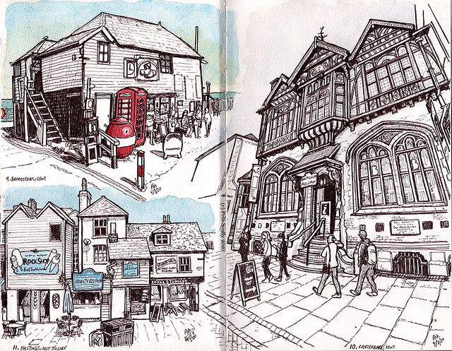
Now for Barnstaple, Bristol and Bath; I like the Bs, I like to make them rhyme. After a brief whistle-stop tour of Cornwall we are back in Devon, but this time North Devon, which is different. Devon’s a big county. First stop is Barnstaple, which I wanted to stop in because I have been there twice in the past couple of years, and I had wanted to draw this bookshop. Barnstaple is where my uncle Billy lived, until he passed away last year. He loved his music, knew more about music than anyone I’ve ever known, I still have several old Beatles and Pistols records that he gave me when I was a kid, but he also loved to read and had a huge library of books about music and crime in his living room, so sketching a bookshop seems appropriate, though I couldn’t find a good record shop to sketch. Right opposite this bookshop is an amazing chip shop. Seriously amazing chips there, but I always like chips in towns like this, usually a lot better than in London. When we visited Barnstaple for his wedding, my older brother and I stayed out late one night playing pool and afterwards went to a kebab shop near here to get some sort of local food called a “Jemmy Twitcher”. It has every kind of meat in it, plus lots of other stuff. I didn’t eat one but fair play, my brother did and he finished it. Helped sop up all the Guinness! So that’s Barnstaple. I remember coming to North Devon when I was a teenager, well just over the border in Somerset, camping with our local youth club, we did some into Devon a lot for activities like canoeing and walking about.

I’ve never been to Bristol. It’s been in the news lately, with statues of slave-traders going into the river. I didn’t really know much about Bristol as a city, except for the two football teams – City and Rovers – and the accent, and even then I couldn’t pick the accent out of a crowd. I know people who went to university there, I think, it always seemed like a college town people used to live in but now live somewhere else (bit like Davis). So the virtual tour was an eye-opener, it looks like a really interesting place, and a bigger city than I realized, lots to see and sketch, lots of places to walk, the big Clifton Suspension Bridge, there’s a cool looking market area, but I just really enjoyed all of the terraces of old houses, usually with different coloured doors. There was something really characteristic about them. So that’s what I drew. I must have virtually walked around the whole town. I wish I had been there in real life.

Something I noticed a lot which made me really sad was looking at the Google Map and everything, cafes and shops and pubs and especially theatres, everything had “temporarily closed” next to the name on the map. That was horrible, this whole thing is horrible, but these cities are their places and this virtual tour was one of imagination, imagining what it would be like standing there on the street, wandering through that market then popping into that pub for a local beer, to listen to that accent, but it’s not to be. Some day perhaps, I just hope all these places are still open when we come out of this. On that note, I went to the next spot on the tour, one I couldn’t miss out, and that’s Bath. I have only been to Bath once before, on a day trip from London when my wife first moved to England, with a tour group of Americans in the UK on student-work visas (we went to Stonehenge that day too), and it was very pretty. All the buildings are the same colour though, all made from the same type of stone. When I was a kid Bath was in a small county called Avon, named for the River not the Lady, but now it’s just part of Somerset. This drawing is a place I think we came for tea, Sally Lunn’s Historic Eating House, a little cafe named after a Huguenot refugee called Solange Luyon who became known for her delicious buns. People called her Sally Lunn because they couldn’t pronounce her name properly, but mostly they wanted to make it rhyme with “bun”. The thing called Sally Lunn’s bun isn’t even a bun, they just call it that to make it rhyme with “Sally Lunn”. See? Logical. So “Sally Lunn’s Buns” it is. They look pretty massive, Sally Lunn’s buns.

Ok that’s that. The next chapter in the virtual tour of the island of Great Britain takes us into the country of Wales. I am reminded of a joke I loved as a kid, “How do you get two whales in a Mini? Drive down the M4”. Now I live in America nobody gets that joke, so I have to try making a local equivalent, Americanize it. “How do you get two whales in a Ford SUV? Stick em in the back seat with the two giraffes!” It’s not quite as funny, but it makes me laugh on the inside. I suppose I could try it with a smaller car, like a Prius or a Corvette. “How do you get two whales in a Corvette? How the heck would I know, wise guy!” You have to do the 1930s gangster voice and say “myeaaaah, shee” as they did. I suppose I need to use an equivalent road, but it would have to go to a town that sounded like Whales, or maybe somewhere more American that sounds like a big animal in a small car. “How do you get two Antelopes in a Mini Cooper? Drive up I-80 past Sacramento!” That’s quite local for our area, I suppose, one for the Davis folk. Or maybe not an animal, how about “How do you find two needles in a garbage truck? Drive down Route 66!” Needles is a town that is on the old Route 66, at least it said so when I went there, the map says it’s actually on 40. No, best stick with the old classic, but even then it only works of you live in London or along the M4. Bath is close enough for it to still work. If you live in Wales you’d have to say “How do you get two baths in a Mini? Drive down the M4 and then turn off the A46 at the Tormarton Interchange!” Which we can all agree is much funnier. Right, see you in Wales!

(18) Plymouth, (19) St. Michael’s Mount, and (20) St.Ives

GB 18-20 sm
We are off to Cornwall, the southernmost tip of the island, but first one more stop in Devon. The big lighthouse there is at Plymouth, a fairly decent sized port city on the river Tamar that borders Devon and Cornwall. My only experience of Plymouth was passing through on a coach when I was 16, by myself, crossing the Tamar Bridge. I was off to visit my friend Kevin, who lived in Devon, while my family were holidaying in Cornwall. Cornwall was beautiful, but they were arguing and I was old enough to say, actually can I go and visit my friend Kevin cheers see ya bye. Plymouth makes me think of Francis Drake playing bowls while getting news of the Spanish Armada in 1588 and being totally like, yeah when I’m finished with this game alright, no come on on Drake you have to come now, oh FINE I’ll just finish this one game; we’ve all been there. I bet his mum used to call him down like ten times for dinner while he was playing Minecraft or something. We also think of Plymouth when we think of the Mayflower. It’s funny, I listened to a podcast about the Mayflower recently and it actually debunked some of the legends we think we know when it comes to the Mayflower. For example, it didn’t sail from Plymouth, but from Southampton. I know, right! And it was apparently the biggest ship ever, and wasn’t full of pilgrims but rich people drinking champagne, and it never even got to America because it hit this big iceberg and the band kept playing Celine Dion music as it sunk, and this one man who was the King of the World ended up sinking while his girlfriend floated home on a piece of wood. Nothing about the first Thanksgiving, none of those tall buckled hats, it is surprising what you can learn.

And so, we move into Cornwall, still travelling along the South Coast, which down here is full of cliffs and coves and caves, myths and legends and tales. Cornwall on a map is technically “in” “England” but it’s not England. Cornwall is an ancient duchy with a Celtic heritage, its people most closely related to the Welsh and the Bretons, left over after the Angles and Saxons came over from the continent . In fact those pesky Angles and Saxons drove a whole bunch of those “Britons” over the sea to Armorica in northern Gaul, which we now call Brittany. There’s still a lot of cultural heritage shared between these areas. I chose to draw St. Michael’s Mount, which is a beautiful little tidal island jutting out into the English Channel. There is another one across the sea in France called “Mont St.Michel, on the Norman/Breton border, but it’s much bigger than this one. St. Michael’s Mount is nonetheless like something from a fantasy book, and probably looks nice at sunset. St. Michael though makes me think of the clothing brand from Marks and Spencer.

I decided not to draw Land’s End; I had already drawn St. Michael so another clothing brand straight away would not have been a good look. So I circled back around Cornwall to the town of St. Ives. Made famous by the rhyme with the stupid question at the end, St. Ives was also the name of a butter when I was a kid, if I’m not mistaken. [Edit after some clever clogs tells me no it’s actually not that, it’s St.Ivel] Sorry, turns out I am most mistaken, it’s St.Ivel, but nonetheless St.Ives makes me hungry for butter. [Edit after some clever clogs tells me it’s not butter it’s “buttermilk spread”]. Well it tastes like butter. It has a Swedish flag on it. [Edit, no technically it’s not] It looks very pretty there in St.Ives though. I really liked the look of this pub, the Sloop Inn, which according to the sign dates from 1312. I bet it’s one of those places on a wet and stormy evening would be warm and cosy with bearded old seadogs drinking scrumpy. But what I like most was that in the Street View photo, all the people sat outside are clearly aware of the street View camera and are all waving and smiling, and I liked that. Unless they were saying awful things which they might well have been for all I know. Nevertheless, while I drew this, nobody could get close to anybody in public places so it already looked like a distant time past. I enjoyed walking virtually around St.Ives though, and along the rest of the Cornish coast. I’d like to come here some time and look for Arthurian sites, and pirate coves, and salty old pubs, and sit on the cliffs looking out at the Atlantic towards America, and think back on all those people from the Mayflower who hit that iceberg, singing “my heart will go on.”

Next up: back to Devon! I forgot something!

(15) Bournemouth, (16) Exeter, and (17) Brixham

GB 15-17 sm
And just like that, we are in Dorset. Virtual tours go quickly. Hampshire might be a big county with a lot going on but there’s a lot to see. Bournemouth is the next stop, but I’m avoiding the beach because there are crowds of people, so I walked virtually inland to see if there was anything else to draw other than the pier. Time for the first church of the book, and this one is very tall, the 1879 church of St. Peter. Good name that. I have never been to Bournemouth but I know people that live there. My mum actually went there last week for the first time. It’s a popular seaside resort town, looks like a nice place for a weekend away, but I’d probably prefer somewhere a little less popular. The local football team, Bournemouth, got relegated from the Premier League this season after a few seasons, and I still can’t quite believe that Bournemouth were in the Premier League. I hope they come back some time.

Right that’s Bournemouth and Dorset done with, time to move along the coast. This is where I really start editing out the stopping points. I’d like to visit Poole, and Portland Bill, and I hear Weymouth is nice, and of course the Cerne Abbas giant in the hills further inland. I need to get to Devon though, one of my favourite counties. when I passed through Exeter last year I never left the train station, though I did sketch the platform. IF I’d had time I would have visited the cathedral, so I went there virtually on this trip instead. I couldn’t get a great view, and I’d dug myself into a bit of a corner for space on the page, so I just drew what I could. Little dash of colour from the bunting. Exeter goes back to Roman times, though their football team Exeter City’s nickname is the “Grecians”. It’s not clear why, some say it might be because of their location outside the city walls in St.Sidwell a century or so ago gave people the idea that they were the Greeks (or Grecians) outside the walls of Troy, honestly the things people think up. Dundee United’s fans for example call themselves the ‘Arabs’ because years ago they had lots of sand on their pitch, true story. Their other nickname “Tangerines” makes more sense given their orange shirts. Portsmouth are “Pompey”, a nickname for the town which could come from a number of origins but one I like is that Charles II’s wife Catherine of Braganza thought Porstmouth reminded her her Bombay, and mispronounced it. Bournemouth are the cherries, makes sense because of their historically red shirts (also apparently fruit orchards nearby their ground when the club was founded). But Exeter are the Grecians, but I’m not sure what they’ve done to urn it.

Always with the puns. I could write a book about football club nicknames but I don’t want to. My brother and I used to quiz each other on them years ago, the Shakers and the Quakers, the Addicks and the Latics, the Eagles and the Seagulls. But time is pressing and I have to move along. I couldn’t find anywhere I wanted to draw in Torquay or any of the surrounding towns, until I found Brixham with its pretty little harbour. Again though, it got a bit squashed into that corner. Pages like this made me rethink the spread layouts a bit, and the next few will evolve a bit more until I start getting much more out of the space. Brixham is on the southern end of Torbay, and apparently this is where the Dutch William of Orange landed with a big Dutch army on his way to taking the crown in the “Glorious Revolution” of 1688. That would be William the “No no no, I’m not a conqueror! I was totally invited here! And my wife Mary is the current-but-soon-to-be-former King’s daughter. All good? Throne please!”. King Billy, they call him in Northern Ireland. Yeah, that’s a story for another place, let’s leave William behind and move along. Brixham apparently has a big Pirate festival every year, which sounds like something I’d want to go to. This is getting into Pirate country down here in the SouthWest, especially once we hit Cornwall, in the next post. Bit more Devon to come yet though (I do like my cream tea and Devon fudge).

(12) Eastbourne, (13) Brighton, and (14) Portsmouth

GB 12-14 sm
The virtual tour continues along the south coast of England. I decided to stop off in Eastbourne, haven of older people, and draw part of the Pier. Eastbourne, like Hastings, is in East Sussex. I never pointed out that Hastings is not in Kent last time, I forget that it isn’t always obvious to non-English people what English town is in what county. Anyway Eastbourne is definitely in East Sussex, because I just looked it up (I had no idea). Sussex for those unfamiliar with old English history is named after the South Saxons. King Alfred’s kingdom of Wessex, they were the West Saxons. Essex was the land of the East Saxons, who drove whatever the horse version of the Ford Capri was. There wasn’t a Nossex as far as I know, unless you count the film “Nossex Please We’re British”. I am from Middlesex, which now makes up most of London and no longer exists as a county, except in my old address. Back to Sussex. I always forget what order all those towns on the south coast come in. There are lots of cliffs, and not far from here is the massive Beachy Head. So let’s move along from Eastbourne…

…we now find ourselves in Brighton, still in East Sussex. That long drawing across the top of the page, that is the Royal Pavilion, built for the Prince Regent a couple of hundred years ago. The Prince Regent ruled at a time when it was normal to be ruled by a rich womanizing buffoon with messy hair who everyone hated. Thankfully he had architect John Nash around creating all sorts of amazing buildings and roads and other projects, and the Brighton Pavilion is wonderful, I remember seeing it as a kid and just thinking it was the most exotic building I had ever seen. We used to come down to Brighton when I was a kid, even though the beach is all stones I would still get a bucket and spade, and a stick of rock, and maybe an ice cream with a flake in it (a “99”), Brighton was always a favourite seaside spot. One other time in Brighton as an adult I visited my mate Gilbert, who was at uni there, and we went to this crap nightclub, then went home and played Championship Manager all night. Well, he played, I just watched. Then I remember spending one new year’s eve in Brighton with some friends, and we joined a group of other people who do this thing where all of them have a party the same night, and they just go to each others’ homes, so I think we ended up going to something like seven parties that night – the energy of youth. They weren’t wild affairs, just friendly low-key gatherings, conversation and snacks and cheap beer. I recall one of them was spent playing Trivial Pursuit with members of the band the Wedding Present (I’m not very familiar with them). And then I somehow got separated from the people I was staying with, and this was before cellphones were everywhere, and had to find my way back to their house just using my natural navigator instincts; unfortunately they lived in a house just off a big roundabout called Seven Dials, and could I remember which street? Could I flip. I walked about for HOURS trying to find the right house, I was cream-crackered, it was freezing, but I somehow found it, and slept and slept. Mad times in Brighton.

Ok next up is Portsmouth, passing right through West Sussex and into Hampshire. I last went to Portsmouth when I was a kid with my neighbours to see HMS Victory, Nelson’s flagship. I would love to go back and draw that, but I chose instead to pay homage to local football team Portsmouth FC, aka “Pompey”. This is their home ground Fratton Park. It’s not like I’m particularly a fan of Pompey, but I did watch them beat Spurs at White Hart Lane back in 1988 I think it was, and even though they were already relegated, they completely outsang us the entire game, an enormously vocal bunch of fans. I never forgot that, I was hugely impressed. “Down with the Hammers, we’re going down with the Hammers” they were singing, referring to fellow relegatees West Ham. So, I drew this stadium. I was also starting to get conscious that I wanted to mix it up a bit thematically, drawing different types of buildings and scenes, and not necessarily the most obvious ones for each place. Some you will find are maybe a bit too nondescript, but mostly I tried to draw churches, train stations, pubs, stadiums, tea shops, department stores, piers, town halls, castles, bridges, ruins, clock towers, and even a fruit and veg shop.

After Portsmouth I decided to give Southampton a miss, not even go to the Isle of Wight (where I spent a fun school trip week back in 1987), and head to Bournemouth, which I was surprised to find much closer by than I realized. See you at the seaside…

(9) Broadstairs, (10) Canterbury and (11) Hastings

GB 09-11 sm
Leaving London by the south you come to Kent. The Garden of England, so called because that’s what you concrete over to build a front drive for your truck. Lot of history in Kent; dialectally it was supposedly different from the rest of Anglo-Saxon England, but more importantly this is where Canterbury is, the very important seat of the Archbishop. But more on Canterbury later because I decided to whizz straight to the coast to the small seaside town of Broadstairs. I have never been to Broadstairs, but I hear it is quite nice, and that Charles Dickens used to come here (then again he went everywhere). I found a wooden building with a clear view of the sea and drew that, red phone box and big red buoy thing in the foreground. This is right down at the southern end of the North Sea, where it meets the English Channel and the wide gulpy waters of the Thames Estuary. “Estuary English” is what some people call the dialect in the southeast, Essex and Kent and London, somewhere between popular London/cockney and standard RP.

Ok, back to Canterbury. Going geographically I should have put this as number 9 but it’s too late to fix it now. I’ve been to Canterbury once, visited the impressive Cathedral, and I want to go back and draw the Cathedral some day but not on Google Street View. You can’t get a good view, and there are other things to draw. This amazing building is some sort of local museum or library or information centre, or all of them, one day I will come in person and find out. Canterbury is also another place that’s on Watling Street, the historic Roman road I mentioned a couple of posts ago, although the straight road bit is a little harder to track down. I bought a book recently called “Watling Street”, written as a journey all along the modern day ancient road, with stories that like the road go on fro a bit too long. Like the road, I’ve not finished it yet because I just stopped when I got to somewhere I liked and went somewhere else. Canterbury is of course the focal point of the Canterbury Tales, Chaucer’s great work, and even there the pilgrims never actually made it there, because even Chaucer got a bit bored making jokes about how badly they speak French in Stratford and decided to just switch off his television set and go out do something less boring instead. I know how it is, I’ve been blogging since the mid-2000s and still haven’t come up with a suitable ending.

I decided to skip Dover, because evidently places like New Cross Gate and Broadstairs were much more of a priority, and so missed out on drawing the White Cliffs. It’s not that easy from Google Street View anyway, since most of the streets are on the other side of the cliffs. The White Cliffs of Dover are so-called not because of the chalk but because of all the bird poo on them. I know you don’t believe me but it is true. If you listen closely to the most famous song about the White Cliffs of Dover, “The White Cliffs of Dover” by Dame Vera Lynn (may she rest in peace), it says clearly that there are blue birds over the White Cliffs of Dover, and anyone who has parked their car underneath a tree full of blue birds knows what that means. But I didn’t draw Dover, and proceeded with haste to Hastings, number 11 on the sketch list.

Hastings is famous for the Battle of Hastings, which took place in nearby Battle, which was known locally as “Battle, just off Hastings”, and which in time became “Battle of Hastings” in time, so I can see where the confusion might arise. That was in 1066, and William the Conqueror beat Harold Godwinson to win the country. This was long before General Elections and Referendums and Twitter. 1066 is the date we all learn about at school, and we say “ten-sixty-six” not “one-thousand-sixty-six”. Harold did win a battle just before Hastings, the Battle of Stamford Bridge (it was against an army of Norsemen let by Harald Hardraada, not against an army of Chelsea fans led by Harry HardBastaard). Still, it was like having a semi-final against your big rivals, going to penalties, then having to get on a coach to the other side of the country to play the final against a team that basically walked their semi-final 6-0 against Luxembourg or someone. The Anglo-Saxons lost that one, and it would be exactly nine hundred years of hurt until they would eventually win the World Cup. Even Chaucer, in a lesser known Canterbury Tale called the Skinner’s Tale, mentioned a popular song from the 1360s called “The Leons Thre”, which went as follows: “Thre Leons embroidered on a vesture, The gleme of Joules of Rhemes, Of Hurt ther was, thre Hundred yeer, That nevere stynt my drems.” Not really, I made that up. I have been to Hastings, a long time ago when I was a teenager, when we spent summer holidays nearby at Camber Sands holiday park. I remember it being an interesting seaside town, full of all the things I like about seaside towns, shops selling sticks of rock and toffee apples (the stick of rock is a fundamental British seaside thing that I miss so much), bingo, and also a nice looking castle overlooking the channel. Another place I would like to go back to in real life.

In the next spread, we move along the south coast to Brighton, Eastbourne, and Portsmouth, before going to Bournemouth, Brightbourne and Portston, followed by Eastmouth, Bourneton and Brightport. You can see why I left all the ‘hamptons out of this trip.

(6) Stratford, (7) New Cross and (8) Tooting

GB 06-08 sm
Going east from the city, this is the last bit of vaguely familiar territory for a while for me. On the left, number 6, that is the Town Hall at Stratford in east London. I have been inside there once, while I was a student at Queen Mary University of London in nearby Mile End, and I took a French exam there. I studied French, though I probably didn’t study it as hard as I could have. I lived in Belgium and France for brief periods, but my French is not the best. Chaucer made a joke in the Canterbury Tales about one of the pilgrims, the Prioress, speaking only the French of “Stratford at Bow”, not the “proper” Parisian French (“And Frenssh she spak ful faire and fetisly, After the scole of Stratford atte Bowe, For Frenhssh of Parys was to hire unknowe.”) Seems to me he was making a joke at my own poor French, learned at Stratford atte Bowe, seven hundred years early. Oh well. You may know Stratford from the 2012 Olympics in London, that was a beautiful occasion wasn’t it, still my favourite opening ceremony, made me miss home for sure. I’ve spent a bit of time in Stratford over the years, seen it change, I would never have guessed the actual Olympics would end up there some day, but that happened.

Right let’s not linger, time to jump on the Overground and end up in New Cross Gate, across the river in southeast London. Have I ever been to New Cross? I don’t think I have. It was always one of those places I’d see interesting indie club nights advertised on fliers handed out in Soho or Camden, but then I’d see where New Cross was and I lived in the complete opposite end of London. If it was beyond the river, yeah probably too far. I don’t know south London very well; as a north Londoner you grew up with a lot of people basically acting like it was a different city entirely. They talk different them Saaf Landoners, and there aren’t as many tube lines down there, and cabbies won’t go saaf of the rivah after dark, see. Not that I ever got a cab anywhere. I did get to know some of south London in the late nineties though through the medium of going out with women that lived in Clapham. That’s an interesting area, divided into Clapham North, Clapham Common and Clapham South, but there’s also Clapham Junction but that’s not on the Northern Line. It’s an area so full of European au pairs that my friends referred to it as “Nappy Valley”, though I didn’t get the pun on Napa Valley at the time, I assumed it was some saaf London thing. I love that we call it “saaf” London, even though I also pronounce “south” as “saaf” more than half the time. My norf London accent can be quite thick, even now I’m Californian. For example when I was a kid, true story, I though Bran Flakes were called that because of their colour, because they were “Braan”, literally brown flakes. Not all norf London speaks like that, in fact there are loads of slightly different accents across London, but most Burnt Oakers like me have quite strong cockney voices. So no, I’ve never been to New Cross. Why did I include it here? Not sure, maybe I really wanted to go to nearby Goldsmiths College years ago, doing art and whatever else they are famous for, but I ended up choosing Queen Mary and studying French and Drama, and life takes whatever turn it has to.

Right, turning away from New Cross, I now have to get across south London somehow to reach Tooting. I probably should have left this stop out, or drawn Greenwich or moved directly to Canterbury, but I didn’t want to be so dismissive of South London that I would draw New Cross and then be like right, that’s all there is. So I went (virtually) to Tooting, which is a stop on that lower part of the Northern Line, the line that stands on one leg, and a place I have never been. I know it only from that TV show that was on when I was about 3 or 4, Citizen Smith, with Robert Lindsay as Wolfie Smith. Aparently when I was 4 and filming a TV show at BBC TV Centre in White City I saw Lindsay and went up to him excitedly. My mum told me that years later. Never been to Tooting, but I’ve been to nearby Balham a couple of times, both times going to parties there in my early 20s. Being on the Northern Line, that meant I could get home without changing trains, theoretically, so I wouldn’t be lost in the wilds of saaf London. This sketch is of Tooting Market, which looked interesting but I will probably never go to. Maybe I should have drawn Croydon, that’s a more interesting place, but in my mind I probably still thought, yeah but I should be near the tube so I can get home in time for dinner and watch Gladiators and Noel’s House Party, even though actually I’m sitting at a desk in California in 2020.

Ok, enough norf-London bewilderment at saaf-London, now time to get all London-centric with the rest of the country. Next stop, Canterbury! (checks notes) I mean, next stop Broadstairs! Broadstairs?

(3) Camden Town, (4) Soho and (5) The City of London

GB 03-05 sm
I may have spent too long in London on this virtual journey, not leaving space for some other places along the way – your Southamptons and your Swindons, your Leicesters and your Lutons – but in my defense I am from London, so I don’t mind being London-centric, and also I didn’t see anything I wanted to draw in those places, although if I went in real life undoubtedly I’d feel different, except in Luton. London is so big and diverse though, and I was still looking at places that meant a little to me. The next stop was in Camden Town, top left in this spread. This is Camden High Street, the point where the railway bridge crosses the famous Camden Market. Camden Lock itself is around the corner from here, where the Regents Canal cuts through on its way from Little Venice to the Docklands. I come out in Camden almost every time I come back to London, as it is easy for me to get to and all my old favourites are there, even if they aren’t really my favourites much any more. Many memorable (and a fair few unmemorable) nights out round here over the years, with the usual lads. A long time ago late nineties early noughties I used to go to the Mixer with my mate Tel and we’d play pool, or rather he would play pool and I would sit there watching him win game after game while I chatted to people. It’s what I like about the pubs in Camden, you always get a conversation. Not always an interesting one but you meet some characters. Me and my mate Roshe would always get into long drinky conversations with interesting people in Camden, like the fella we met from Sweden a couple of years ago late at the Hawley who was in London to take photos of the Cure. Camden has too many memories to count, but I still think it’s a mess. It’s supposed to be, long may it be.

Right that is enough of Camden, time to go into town and go to Soho. Northern Line maybe, or just jump on the bus, end up on Frith Street, go to get a coffee at Bar Italia. Now it must be pointed out, I don’t drink coffee, I don’t like it at all. Yet the only time I had a coffee drink that I liked was right here at Bar Italia, a cappuccino at about 3:30am, and admittedly it was in about 1996. That is in the twentieth century so yeah, it has been a while. You might know Bar Italia from the last song on Pulp’s Different Class. I used to come here for a little while back in the mid-nineties when I was briefly going out with a girl from Perugia, she worked at a Soho amusement arcade and we would usually meet up at midnight to go to clubs like St Moritz or the Wag, and then with some other Italian friends we’d go to Bar Italia while the sun was coming up, before I’d get my Night Bus back home to Burnt Oak from Trafalgar Square (often getting home and not even sleeping before heading into work at the Asda coffee shop next morning – I really had so much energy when I was twenty). That summer reminds me of 1996, the Euros, that Gareth Southgate penalty miss, seeing the Pistols at Finsbury Park with my uncle Billy, going to the Hellfire Club on Saturday nights with my friend Andrea from Hungary, working at Asda on weekends, and ending up at the end of the summer on a bus to Germany to spend a year which lasted three weeks. Memories that I’m pretty sure happened but all blend together like old posters pasted on top of each other on an old wall that was knocked down years ago. You know when memories of people and places vanish but jump out again in dreams years later? Time to leave that cappuccino behind in Bar Italia and get out of Soho now.

The final sketch in this spread is at Bank, right in the heart of the City of London. The City of London is its own thing, an area known as the Square Mile that has a degree of independence dating back to the twelfth century. Like, we in London distinguish “London” from “The City” but it’s a real distinction – you see statues of silver dragons marking the entrances into the City, it is managed by the Corporation and governed by the Lord Mayor, and if the reigning monarch wishes to enter the City they must attain permission from the Lord Mayor. They also have their own police force – Greater London has the Metropolitan Police, those bobbies from New Scotland Yard, but the Square Mile has the City of London Police, which have distinctively different police constable helmets with little crests on them. The location of this sketch is right next to the Bank of England (left) and Mansion House (unseen on the right), looking towards the Royal Exchange, and a whole load of skyscrapers, new ones going up all the time. This skyline has grown increasingly spiky since I left England, like the City is going through its experimental haircut phase. There’s an open-top bus. The thing this junction reminds me of most are my days as an open-top bus tour guide twenty years ago, I loved going through this are, so much to talk about, and on a weekend when there was no work traffic you had to get those facts out quick, no time for rambling. Mention the grasshopper on the weather vane, talk about the Lombard bankers, catch your breath because the Great Fire is coming up and then you’re at London Bridge. Of course if it’s Thursday afternoon and traffic is crawling you can really start telling stories.

From here, I probably should have moved beyond London on the virtual tour, to give myself a few more spots for your Blackburns and your Bradfords, your Warwicks and your Weymouths, but not wishing to appear North-London-centric I went east to Stratford, and then south-east to New Cross, then south to Tooting, before finally finding the road to Kent, like a Chaucerian wandering about lost, unable to read a map written in the French of Paris when all I know is the French of Stratford at Bow. Dammit I was saving that joke for the next post, not that anyone will understand it. All will be revealed, I’ll see you at Stratford Town Hall…

(1) Burnt Oak and (2) Kilburn

GB 01-02 sm
So off we go, on our journey around Great Britain in 66 Sketches. Not the UK, I hasten to add, but specifically Great Britain the island. I’m starting this journey in Burnt Oak, a north London suburb near the end of the Northern Line, the place where I was born and grew up. That is Burnt Oak tube station, on Watling Avenue. So many stories and memories associated there, but I won’t go into any interesting ones now (because none of them are that interesting). Except that this station is not just the start of this virtual journey, but it was also the start of all my journeys across the world, they all came from here and led back to here. I also used to catch the bus from outside the station. It’s a small little station. When coming home on the Northern Line years and years ago I could always tell when I was getting close, before they had the actual announcements on the train or the little digital display, because of the colour scheme of the stations leading up to Edgware. Hendon Central was painted light blue, then Colindale was yellow, then Burnt Oak was red. Of course I’d be asleep and miss my stop and end up in Edgware and there’d be no more tubes home so I’d have to walk. Same with the Night Bus, the good old N5, those were the days. Always glad I lived only one stop from the end of the line, walking home after falling asleep never took very long. The Northern Line, for those who aren’t aware, is the black line on the London Underground map, the one that snakes up from Morden in the distant south, splitting into two shortly before reaching the Thames and sending two branches through central London, “Charing Cross” and “Bank” (that is, the one through the West End and the one through the City), before high-fiving at Euston and then meeting up again at Camden Town, only to say fare-thee-well once more and race north, one side to Edgware and the other to High Barnet. Not to forget the little branch that ends in Mill Hill East, which happened when people going up to Barnet decided in Finchley that they wanted to go to Edgware after all, but only made it as far as Mill Hill East before giving up. They were supposed to keep going all the way to Edgware and beyond up to Bushey, but then the War happened and they said ah leave it, this’ll do.

So, that is #1 in the journey. To get to #2, you would not take the tube, but you’d walk up Watling Avenue (we just call it “The Watling”) to Burnt Oak Broadway and catch the 32 bus down Edgware Road, past Staples Corner, until you reach Kilburn. This is the Cock Tavern on Kilburn High Road. Now I just named four roads in that past sentence, but one is the odd one out. Can you guess it? That’s right, Watling Avenue. The other three are actually the same road, different names for the road called “Edgware Road” in London, which ironically is part of a much longer Roman road called, yep, “Watling Street”. So when I talk about Watling Avenue as “The Watling”, it’s actually not even the Watling most people know. Watling Street, also called the A5, is one of the great historic Roman roads, straight as an arrow for long stretches, going from Dover to Wroxeter, although the A5 was extended beyond through Wales up to Anglesey. The Romans loved long straight roads, though this virtual journey will be anything but straight. Incidentally, Burnt Oak is historically supposed to have gotten its name from the Roman custom of burning an oak tree to mark mile boundaries along the road, at least that’s what they told us at school.

That is enough Road talk. Let’s talk about the pub, the Cock Tavern. Pubs are an endangered species in England, even before COVID-19, with so many historic drinking spots stumbling and falling over on the pavement before being jumped and given a good kick-in by greedy property developers. For example the Carlton Tavern, which stood nearby on Carlton Vale, was the only building on its street to survive the Blitz, but it did not survive being illegally demolished by an Israeli property developer with no notice nor permission a few years back (they were ordered by Westminster Council to rebuild; have they? Yes, eventually, but not reopened it). So I’m glad the Cock Tavern is still there, a historic pub that dates from 1900. I haven’t been there in about twenty years though. Last time I was there was when I was seeing a woman who lived in Kilburn, which is a traditionally Irish area (as was Burnt Oak, but Kilburn and Cricklewood much more so), and I remember seeing this fight between two quite drunk old men in their 70s all over the outcome of a hurling match between Galway and Tipperary. Very heated it was, they were knocking each other into the fruit machine and eventually outside where I didn’t bother going to watch, but I imagine it was like High Noon, I just got another pint and some dry-roasted peanuts and put The Jam on the jukebox, probably. I don’t know, it was a very long time ago now. There were some good old pubs in Kilburn back then, some day I will get back to London and go and draw them in person. I want to go and draw the whole are in fact; you’ll see that I feel like this about a lot of the places I virtually visit.

The next part of the virtual journey will take us to Camden Town, and you don’t get the tube there from Kilburn, you have to take the Overground from Kilburn High Road to Camden Road, or take a bus, or just walk it (but that takes ages, don’t bother). We’ll cover that next time though. See you down Camden…

Great Britain in 66 Sketches

Map, Great Britain in 66 sketches.
Ok, the time has come to show you one of the projects I started while stuck at home to get through the mind-crushing dystopia of the pandemic. And everything else; seriously 2020 give us a break. Since there is no traveling for us for the foreseeable future (“foreseeable future”, hah, like that is a thing) and certainly no going back home to Britain, I decided at the start of April that it would be a good idea to explore my home island virtually, and with a sketchbook, via the magic of the internet, or more specifically Google Street View. My rule was that I had to fill a single Stillman and Birn Delta Series sketchbook (that I have had sitting in the cupboard for several years, waiting for a time such as this to create a single-themed book with) with sketches from around Britian, but travelling as if on a linear journey, not back and forth but from place to place, starting in Burnt Oak (the corner of London I am from) and finishing in, why not, John O’Groats. The sketches had to be from Google Street View only, not other sources, so that there would be both a reasonable consistency as to the view (height for perspective) and that I would be constrained kinda sorta like I would be in real life: not a great view of the thing I want to draw, well don’t draw it. I would use Street View to explore, going up and down streets all over Britain to find the things I want. I didn’t have a plan when I started as to where I would go or how many sketches I could do, but after the first few pages it became very clear that I needed a plan, and as it turns out there are a lot of places I had to miss out, either through lack of space in the book or just because there was nothing there that made me want to sketch it. I wasn’t just going for the obvious spaces, and perhaps I missed out some great locations, but those are the choices we make when we travel sketch, we aren’t making definitive statements about places, just drawing what speaks to us. Most places aren’t particularly personal to me, but a few places are, places I might have been years ago. Truth is, I haven’t been to most places in Britain – I’ve never once been to Wales, for example, and boy have I missed out – and now I have a real hunger to travel the island in real life. And that was another rule – just the island of Great Britain. Ireland could be another book by itself, and I didn’t have room for the Isle of Man, so I also left out the Isle of Wight, and didn’t go beyond Scotland’s northernmost tip to Orkney or Shetland or the Outer Hebrides, but that would be fun in real life.
So join me in the journey around Great Britain, in 66 sketches – seemed like a good number to stop at, one which rhymes through British history – plus the stories of my epic voyage, which was taken completely at my desk 5000 miles away in California. Or if you prefer to just see all the sketches without the usual ramble and bad puns and “guess-which-bit-is-true” history segments (you would probably have hated my old ope-top bus tour of London years ago), all of the sketches are compiled in one Flickr folder at “Great Britain in 66 Sketches“.

I’ll start posting them in the next post, and you’ll be able to follow them all here at https://petescully.com/tag/GB66