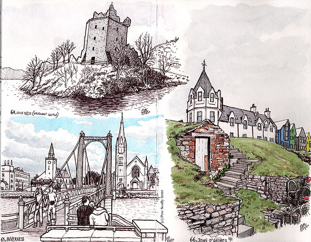
And so, the final leg of our Scottish adventure. We were all pretty tired by that point, I may have had all the Irn Bru I could drink, and all the Tunnocks Teacakes I could eat, but we were off to see a place we’d heard of all our lives but never imagined we would get to see – Loch Ness. And we were in search of a mysterious creature we had heard so much about, seen so many cuddly toys and fridge magnets of, yet had thus far proved elusive – the hairy Highland Coo. We left Fort William and drove up through the Great Glen, which is what we call the huge valley that cuts through Scotland and forms Loch Ness. As opposed to Great Glenn, who was one of the best passers of the ball in football history, though I wish he’d passed at recording ‘Diamond Lights’ with Chris Waddle. The roads were fairly narrow, and the speed limits great, with cars belting around those bends at 60 miles an hour. It was pretty nice though, not raining like on our trip through Loch Lomond, and we all breathed a deep breath when we first saw the great, incredibly deep Loch Ness. It’s the largest body of fresh water in the UK, and is 788 feet deep at its deepest point. The water is very dark, making it nigh impossible to see very much in front of you when beneath the surface. But no, it does not contain an ancient plesiosaur that has mysteriously survived the geological eras to confound scientists and excite tourists, that would be ridiculous. Kelpies, Selkies, Redcaps, Blue Men of The Minch, Giants, Finfolk, Bogles, Trows, Wild Haggis, all of those definitely exist, but Nessie? Please. Or does it…
We took a boat tour out onto the Loch, in the ‘Nessie Hunter’, and our guide gave us a fun account of all the Nessie sightings, and details about the Loch. The boat was equipped with a sonar to detect things moving way beneath the surface, and he pointed out a house that has a webcam trained on the Loch 24/7, so you can go online and look at water, in the vain hope that you will see a head pop out. You’re more likely to see Messi. One of my favourite shows when I was a kid was The Family Ness, a very silly cartoon about a group of Nessies all with different personalities that befriended a couple of Scottish kids who helped them hide from the scientists. I loved the theme tune (“…but you’ll never find a Nessie in the zoo!”). Kids TV theme tunes from the 80s is be my specialist subject. Our guide told us that due to its constant movement, Loch Ness does not freeze over, but I clearly remember one episode of The Family Ness where they were ice skating on the Loch, so I don’t know. The ride was quite bumpy though, lots of waves (I presume they were waves…). We had a great view of the partly ruined Urquhart Castle, on an outcrop in the Loch. That was our next destination. After lunch of fish and chips (Scotland does the best fish and chips) in Drumnadrochit, we visited the old Urquhart Castle, which is where I did the sketch at the top of this post. (I have also drawn it once before, on my Google Street View Tour of Great Britain, during the pandemic). That was a super interesting place with amazing views over the water, and hundreds of years of history. While I sketched, my wife and son had a delicious afternoon tea overlooking the scenery.

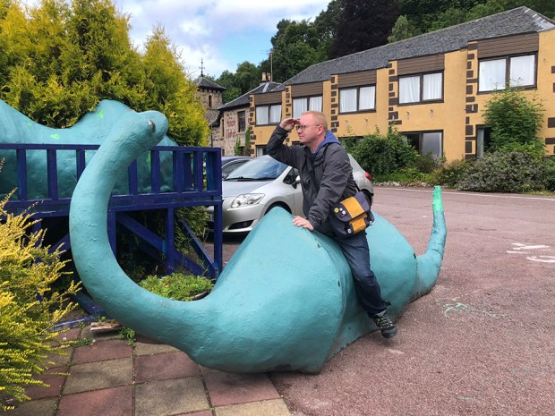
We were flying out of Inverness that night, but we still had one more mission – to find the Highland Coo. That’s a very hairy type of cow with long horns that they have up here, but we still had not seen them. So we found a little guest house and tea room that purportedly had some on their grounds, and after buying some cakes, they let us go and take a look at them. Lovely big beasts they are. We found some more hairy cows a bit further up the Loch, they reminded me a bit of that big creature Ludo from the film Labyrinth. Unfortunately, we had to get going. We drove to Inverness, sat in very slow traffic a couple of times, popped into a gigantic Tesco to buy a sandwich and one last Irn Bru, tried to figure out how to drop the car off, and then flew a very late night Easyjet flight from Inverness to Luton (less said about Luton, and our journey back from there, the better), utterly exhausted. There was no time to visit Culloden on this trip, but this won’t be our last trip to Scotland. There’s so much more to see, more castles to visit, more Lochs and Islands to explore, more trains to catch, and so many more Tunnocks Teacakes to eat. Slàinte Mhath!