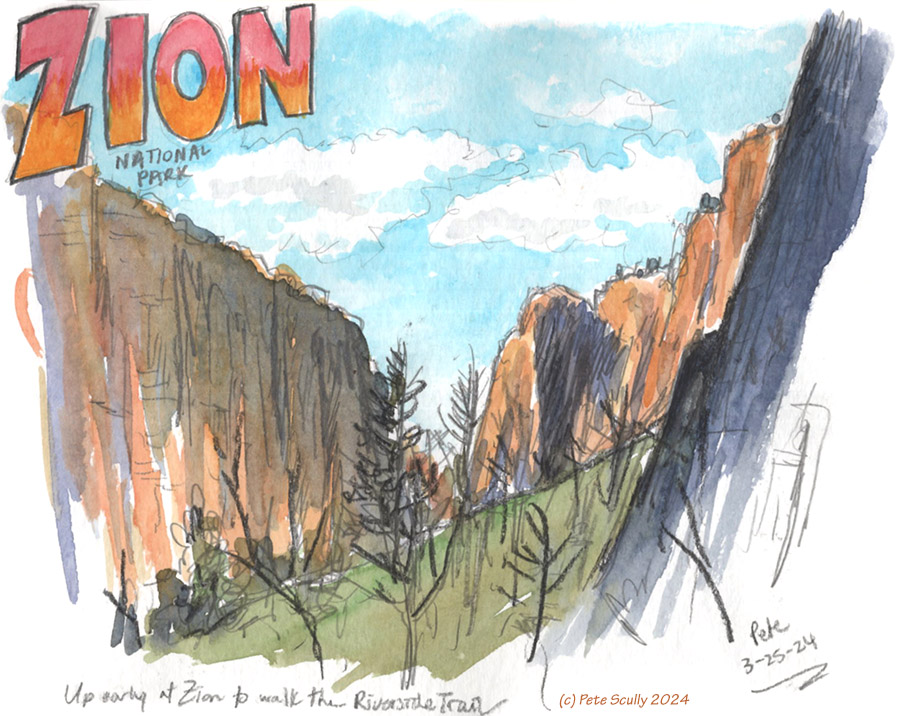
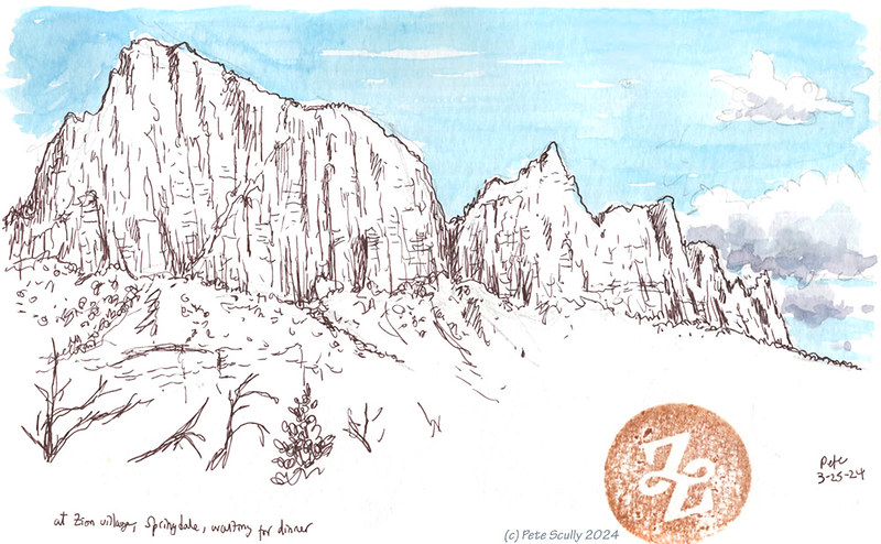
For Spring Break this year we took another trip to southern Utah, to visit some of the beautiful national parks down there. In 2021 we had been to Arches and Canyonlands, staying in Moab after a very long drive from northern California; this time we flew into Vegas and drove to Utah from there, across the desert, passing through a little triangle of Arizona. We were headed for Zion, one of the most famous national parks in America. We stayed in Springdale, a long narrow town that hugs the Virgin River, and our hotel was footsteps away from the park entrance. We are racking up the national parks now, over the past few years. Our room was nice, with a view of red-rocked mountains right from our bed. Zion is one of the most popular parks, and the crowds can get a bit heavy. There is a shuttle bus from the park entrance to get to most of the trailheads in the long canyon, and the lines for this can honestly last 2-3 hours if you get there at the busy time. We went down early, not too early but it was about 8:30am, and there weren’t many people there yet. We got on the first bus, although it’s fair to say the bus was still full, mostly with hikers wearing full waterproof overalls and carrying long thick sticks of wood. They would hiking The Narrows, a well known trail through a series of narrow slot canyons down which you must wade in the cold waters of the river. Usually that might be up to your ankles or your knees; at this time of year it’s more like up to your chest. We weren’t doing that this time, although seeing everyone getting ready for it, I was kind of feeling a little like actually I wouldn’t mind doing that. Then I had a vision of tripping on a rock and going under, and I kept thinking of that one “Charley Says” where the cat falls into the canal and it all gets very sinister. “Charley says, never go into the Narrows when it’s really deep ‘cos you might sick from Toxic Cyanobacteria Bloom.” You might have to be British and from a certain time period to understand Charley Says. Anyway, the Narrows can wait for another time. We got off the bus right at the end to stop #9, at what’s called the ‘Temple of Sinawava’. I drew this sketch above from right there where you pick up the bus. We walked along the Riverside Trail, which leads down to the Narrows, and it was through a deep and pretty gorge, a fairly easy hike.
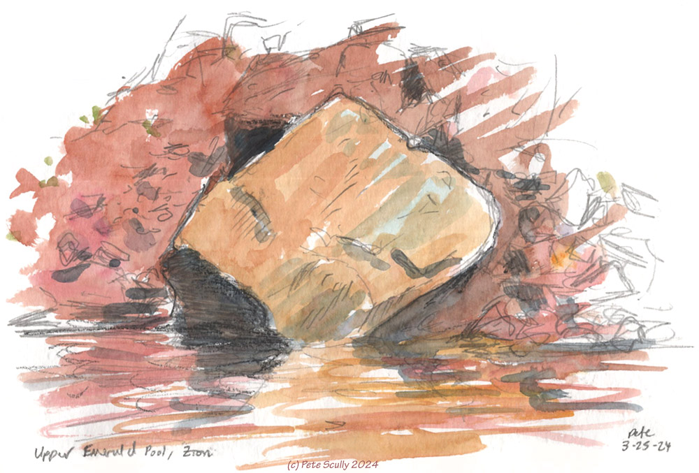 The whole thing reminded me of the big valley where you have to spend a lot of time hunting machines and fighting bandits in the brilliant game Horizon – Forbidden West. It turns out, that whole area (known in Horizon as ‘The Daunt’ is basically Zion in the far future, so as I explored the park for the first time ever, I felt like I knew it really well, it was all so familiar. We got the bus down to stop #6, The Grotto. We hiked up the Kayenta Trail up to the Emerald Pools; the Middle Emerald Pool wasn’t all that, but it was a steep climb up to the Upper Emerald Pool was worth it. It wasn’t really Emerald exactly, more brown, as I think every single person up there pointed out, like it was the most original comment in the world. Having started out quite chilly in the morning, it was turning into a pretty warm day, with blue skies and sweaty legs. I stopped at the top and sat by the pool, which had a waterfall coming into it from a sheer cliff face, and I sketched this large almost cubic rock that was wedged into the waters. I then made my way back down, and rejoined my family to look around the dramatic sweep of Lower Emerald Pool. I definitely recognized this from Horizon. We ate our packed lunch and I did a quick sketch of the rocks above it (see below).
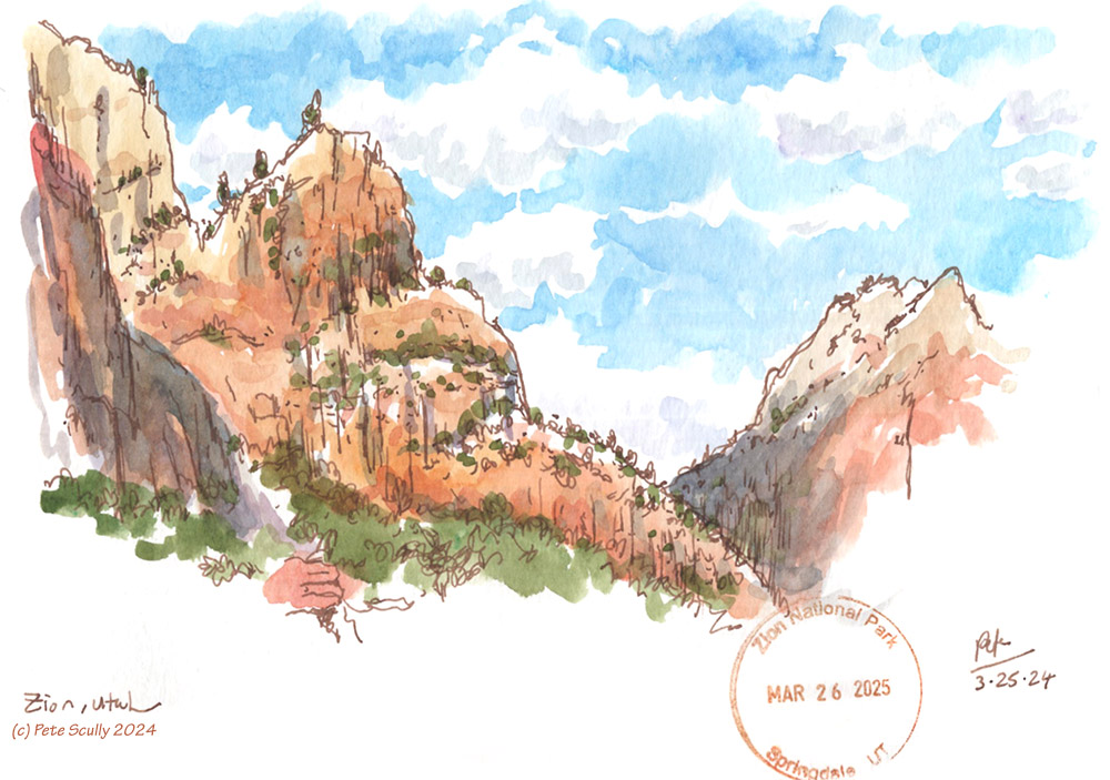
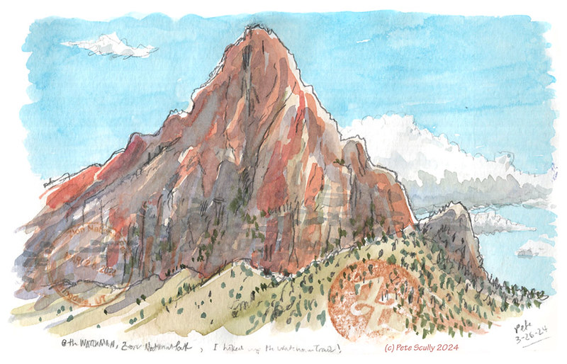
 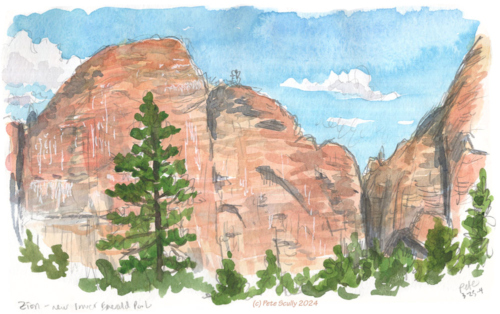 We eschewed the busier trail on the way down (“eschewed”? I don’t talk like that) and walked down a less populous route, peace and quiet, towards the bridge. Of course, the bridge was closed, and it was a good couple of miles before there was another crossing. I mean look, in the video game I could just hop across the water and not even get wet. Life isn’t a video game. In video games, you spend most of the day looking at a screen and pressing buttons, while in real life…more drink! (with cheers to Father Ted there) We walked a long way, being passed at one point by a big group of people on horseback being led by a real-life cowboy with spurs on his boots. I wish I had some spurs, I don’t know what I’d need them for though. I’d wear them on the bus to Wembley just to get a cheap Instagram laugh. We did rest after while, and I did another sketch, see below. I drew this with the brown fountain pen, which was really nice for drawing Zion. I also stamped it later that day at the Visitor’s Center, which for some reason had the wrong date on it. We walked further until we crossed a meadow of long grass and tree branches, and saw a big deer hiding. After going through all the deer puns I could think of, which was surprisingly not many, we managed to find a bridge to cross and caught the bus back to the hotel, where we got straight into bed for an afternoon lie-down. Within minutes of hitting the pillow and daydreaming about maybe hiking the Narrows the next day, a massive rainstorm came into the valley and washed all those silly ideas away. It was nice to be inside and in bed, I can tell you.
More to come!


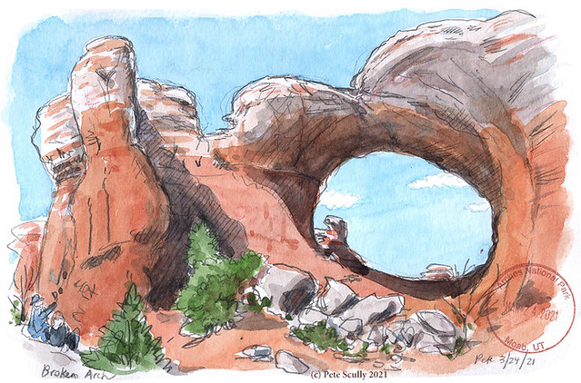
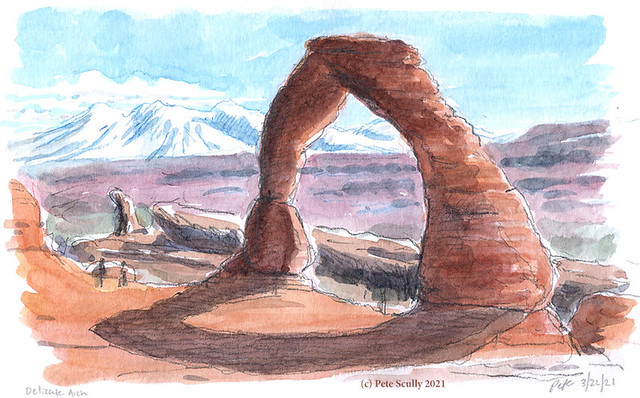
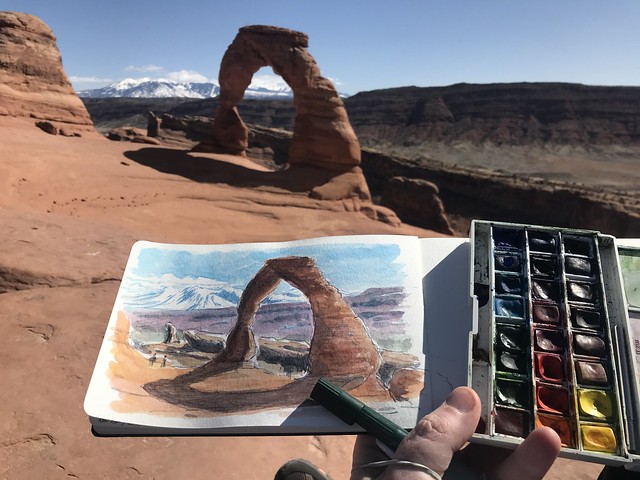
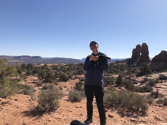
 On the third day in Moab we returned to Arches and this time started our day by exploring the popular Devil’s Garden area. This place is packed with arches, and I’m glad we got there early because before long it was packed with hikers too. People like to do the Devil’s Garden loop, a seven mile or so hike that includes some tricky scrambles over rocks but gives some amazing postcard views. We didn’t do that whole thing, but just went part of the way in. The walk to the long and fragile Landscape Arch was really pleasant, a well-worn path through some short narrow canyons, easy to get to. My son had done a state project on Utah at elementary school a couple of years ago, the main reason we wanted to come and explore Arches with him, as he had made a model of Landscape Arch and wheeled it around the playground in the “parade of states”, this is a popular thing kids learn about at American schools. This particular arch used to have a bit more to it, and the trail would pass underneath it, but then about thirty years ago a large chunk of it fell off, so now you can only get so close, in case more comes down. I overheard a geologist say to his kids while I was there, “hey kids,” (I might be paraphrasing) “he kids, I’m a geologist and I think that more of that rock might come down. All it needs is an earthquake, maybe even a bit of wind, and that rock’s gonna tumble like a lizard in a blizzard,” (Yes I am definitely misremembering what he actually said, I think the Wild West scenery probably clouded my memory a bit). Below, that’s me sketching the Landscape Arch.


")

")
")